
Project
Matterhorn
Year
2026
Software
Houdini
Unreal engine
Synopsis
A terrain study built using real-world LiDAR data sourced from swisstopo.
This project was an exploration of Houdini’s capabilities, from processing large-scale geographic data to developing procedural texturing workflows entirely within the software.
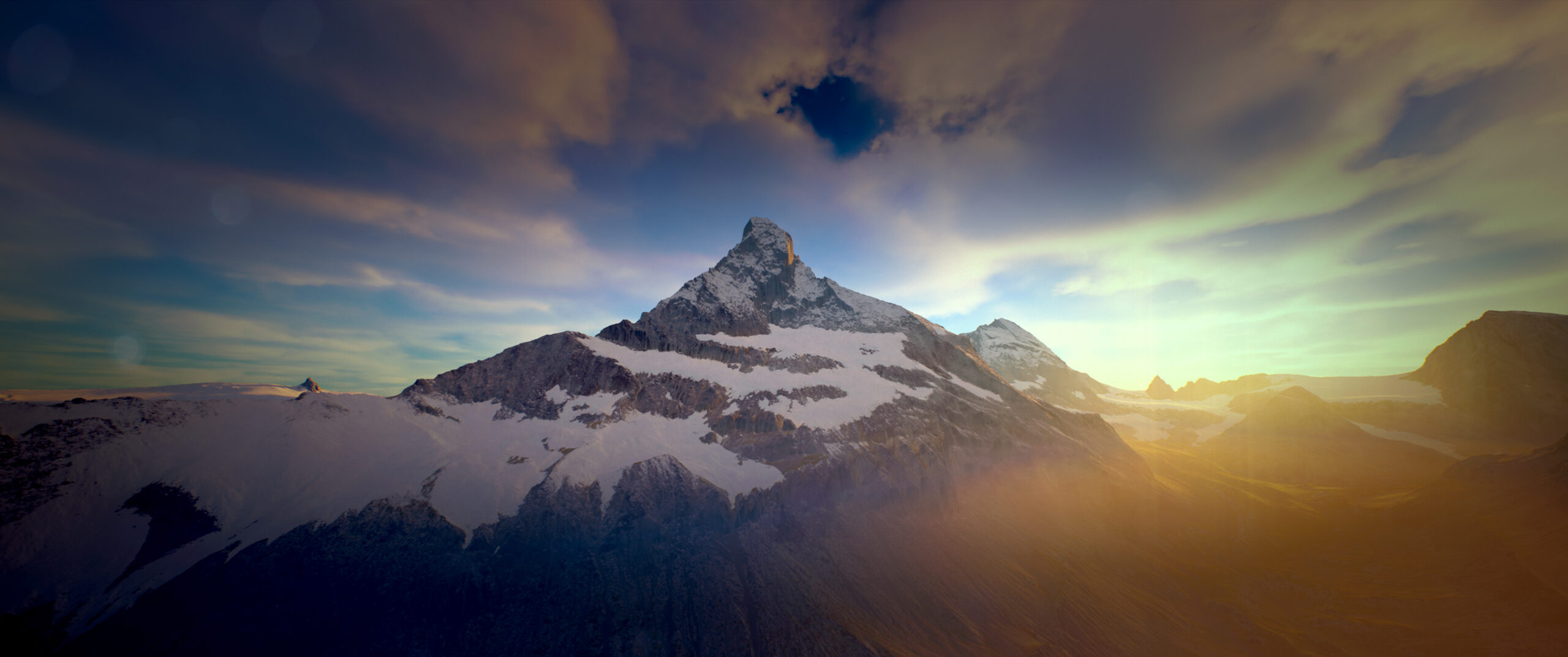
FINAL COMPOSITE
Final composited render of the procedural space station
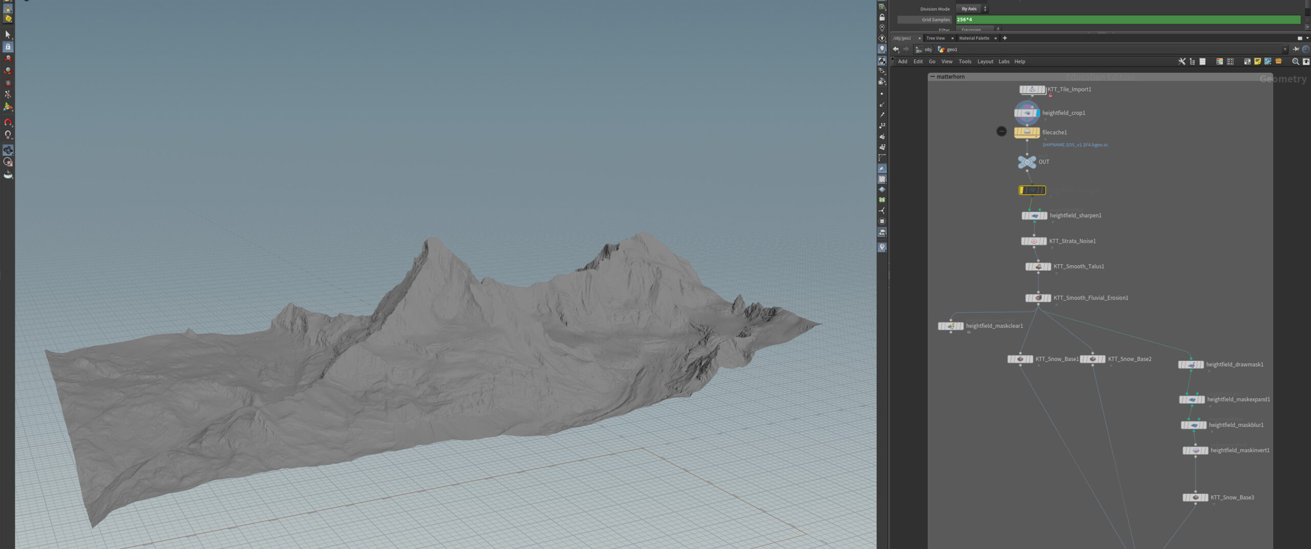
LiDAR Source Data
Raw terrain data from swisstopo used as the foundation for the model.
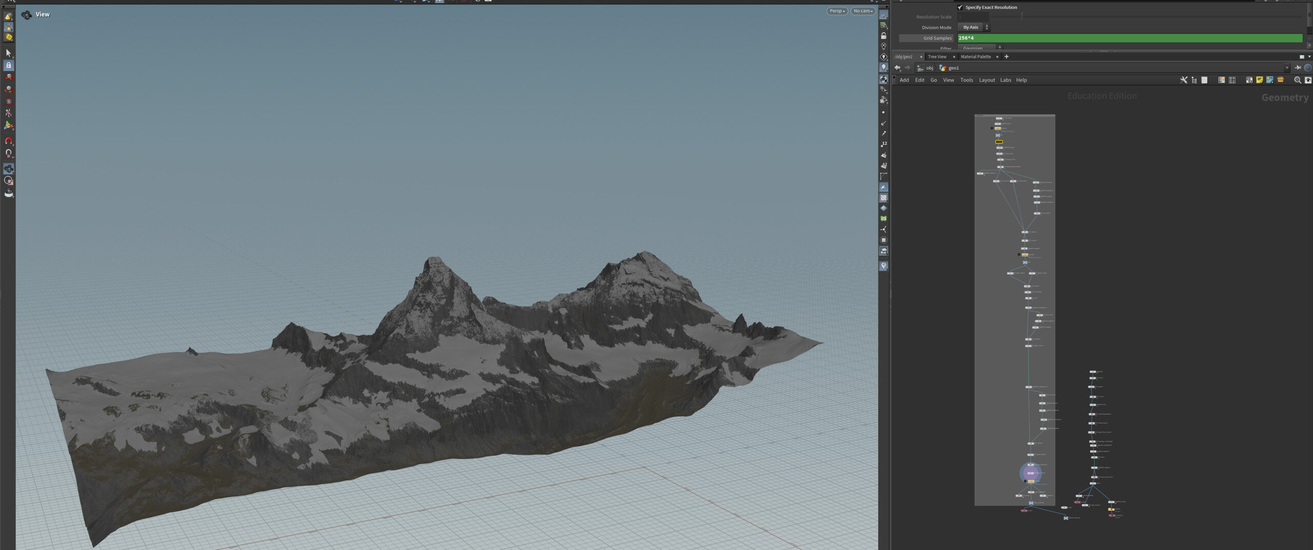
Houdini node tree
Node-based workflow in Houdini used to process, refine, and texture the terrain.
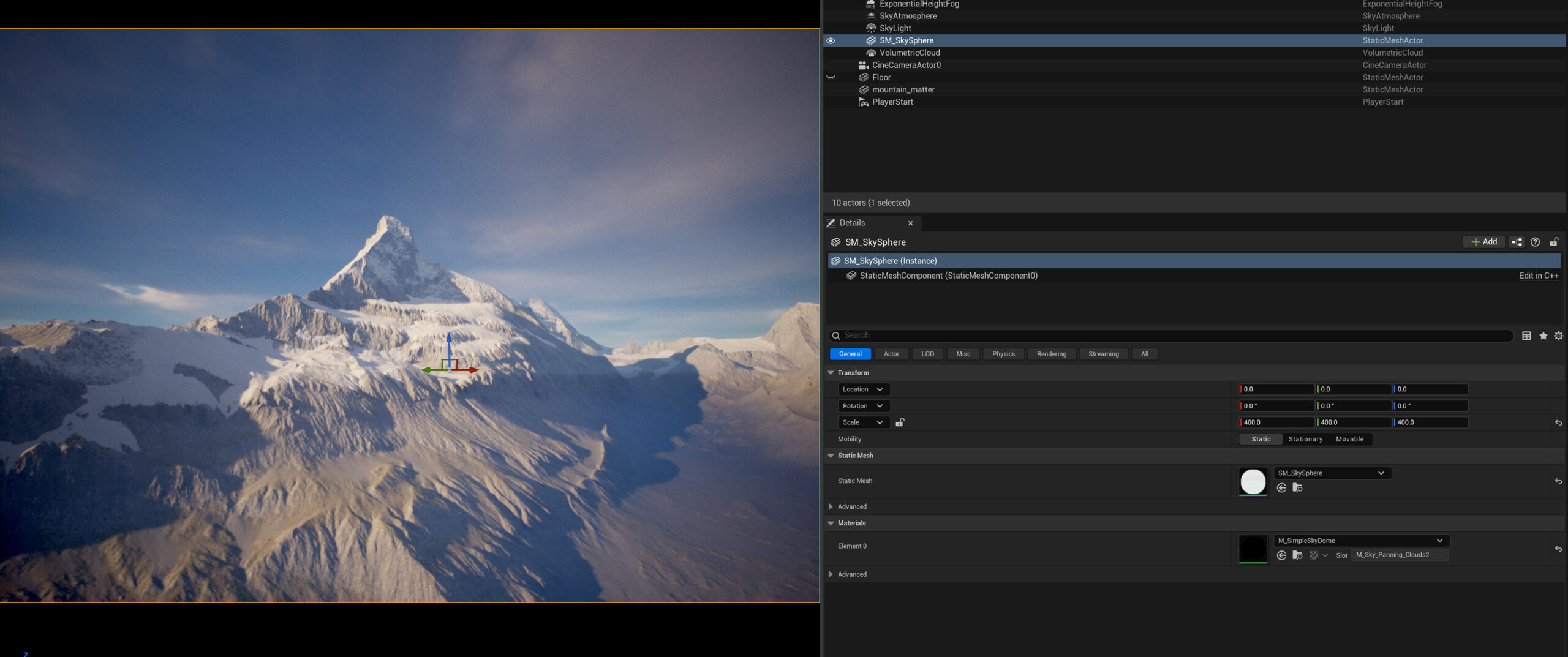
Final Render (Unreal Engine)
The final image was rendered using Unreal engine